Integrate
Bring sensors, systems, APIs and geospatial information into one operational environment.

No-code technology by Focus BC
Mapify turns geospatial and sensor data into rules, alerts and automated workflows — without rebuilding the software every time operations change.
Technology capabilities
Bring sensors, systems, APIs and geospatial information into one operational environment.
See live conditions, location-based events and changing operational context as they happen.
Configure rules, alerts and workflows visually, without writing code for every operational change.
Signal to action
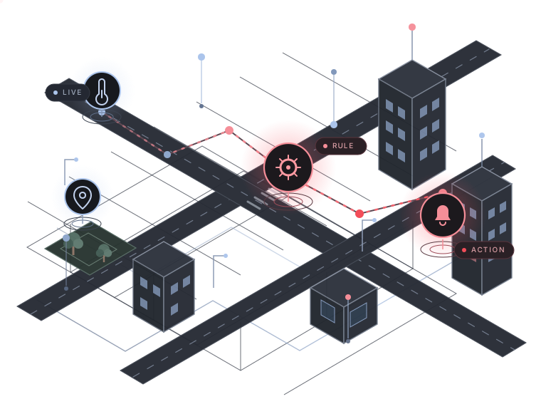
Every live event gets map context, a rule and a clear operational response.
A live signal, event or external data source enters the operational picture.
Mapify adds location context, visual rules and no-code automation.
An alert, task or City as a Platform workflow responds in the field.
Questions
Understand how Mapify works, where it is available and how it supports City as a Platform.
Mapify is proprietary no-code technology developed by Focus BC for geospatial data integration, monitoring and automation.
Mapify is Focus BC's no-code technology layer for geospatial data, IoT and workflow automation. It is currently delivered within Focus BC solutions, particularly City as a Platform.
It supports sensor and data integration, location-aware monitoring, rules and automated workflows for urban operations.
No-code configuration simplifies many workflows. More complex integrations or custom implementations may still require technical work.
Explore the Sensors and Monitoring area of City as a Platform or contact its team.
Built by Focus BC · Powering City as a Platform
Explore how Mapify powers live data, visual rules and automated workflows inside City as a Platform.
Explore the Mapify solution